![]()
Goldmine Trip and Beard Cane Epic
October 22-24, 2010
Read Bill's version of our trip here first.
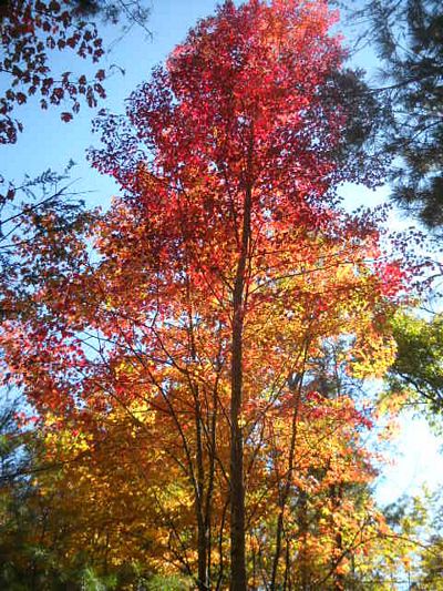
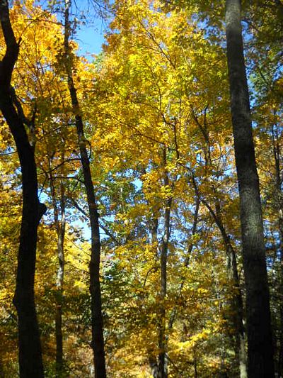
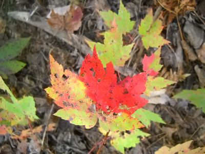
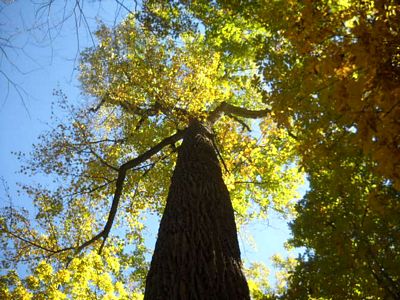
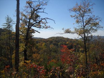
The weather was unparalleled, the leaves were spectacular and the camping was primo. There was a small problem though, and I promised to allow a guest speaker to discuss the events as he has a comedic way of portraying mine and Martin's little adventure He said to give him a few days, so we anxiously await High Speed Alexander's narrative. In the meantime, enjoy these scenes from Campsite 2 and the surrounding area.
(I am still awaiting Bill's description but mine is below)
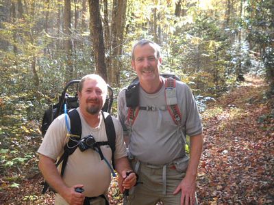
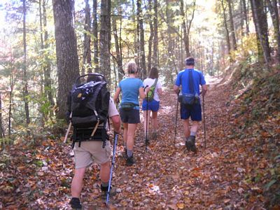 Happy hikers begin their treks.
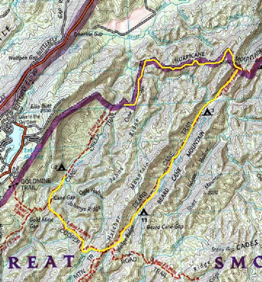 To the left is a map of our original route for the dayhike on saturday. We
began at our campsite, #2 on Cane Creek. Climbing up to Cooper Road trail
we split from Kathryn, Bill and Sarah who were dropping down to Hatcher Mtn and
looping out by campsite #17. Martin and I climbed out to Beard Cane.
We eventually got to campsite #11 where we ran into a few young guys who were
preparing to camp as we moved on towards Campsite #3 and ultimately Ace Gap.
When we got to Campsite #3, some fellows camping there affirmed my suspicions
that there was a manway at Ace Gap. I knew that there had to be a passage
over to Cane Creek as these two trails run parallel. We had no topo map,
just Martin's Spot Locater system, a fanny pack, some snacks, flashlight and a
jacket. The weather was primo so we pushed onward. Climbing up to
the gap from that last campsite was 6/10ths of a mile and it was a climb.
When we reached Ace Gap
To the left is a map of our original route for the dayhike on saturday. We
began at our campsite, #2 on Cane Creek. Climbing up to Cooper Road trail
we split from Kathryn, Bill and Sarah who were dropping down to Hatcher Mtn and
looping out by campsite #17. Martin and I climbed out to Beard Cane.
We eventually got to campsite #11 where we ran into a few young guys who were
preparing to camp as we moved on towards Campsite #3 and ultimately Ace Gap.
When we got to Campsite #3, some fellows camping there affirmed my suspicions
that there was a manway at Ace Gap. I knew that there had to be a passage
over to Cane Creek as these two trails run parallel. We had no topo map,
just Martin's Spot Locater system, a fanny pack, some snacks, flashlight and a
jacket. The weather was primo so we pushed onward. Climbing up to
the gap from that last campsite was 6/10ths of a mile and it was a climb.
When we reached Ace Gap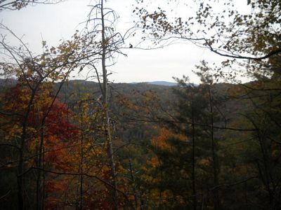
We found this beautiful boundary trail that was fairly
well trodden for a manway. Within .25 miles we came to this junction.
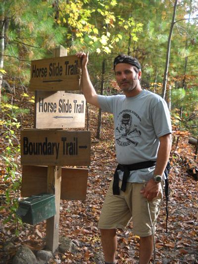 You can imagine our surprise and elation when we stumbled into this. We
were still in the park but these signs belonged to Blackberry Farm. In
that ammo box was a trail map.
You can imagine our surprise and elation when we stumbled into this. We
were still in the park but these signs belonged to Blackberry Farm. In
that ammo box was a trail map.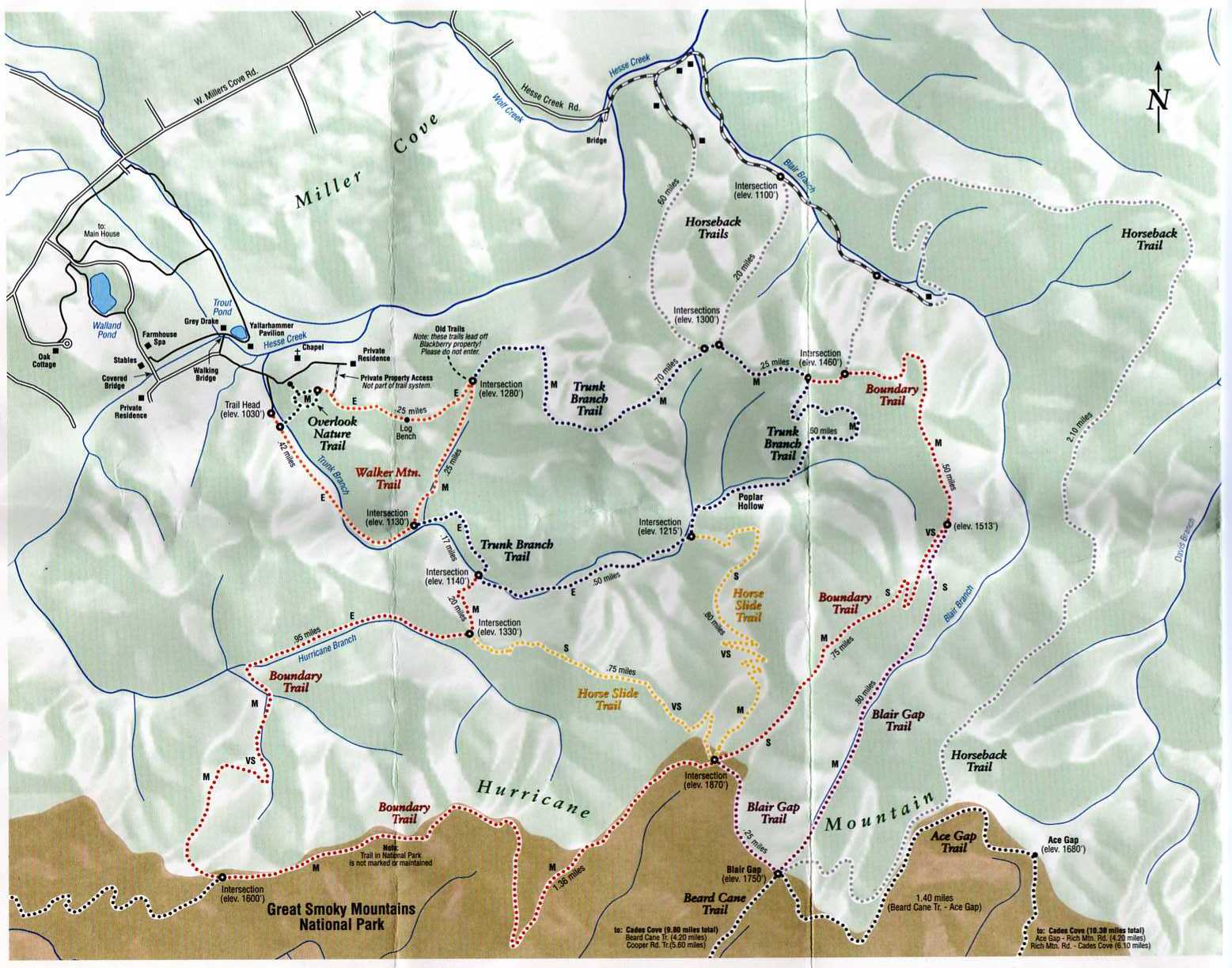
We were obviously at the intersection above Blair Gap as we exited Beard Cane. If this map was correct, we would follow this boundary trail for 1.36 miles and intersect that trail on the bottom left which was obviously Cane Creek which would put us at a mile and a half from our campsite. Bingo. What a coup. We hiked along the boundary trail for a considerable period of time, it was now about 4.20 pm. An hour and a half later, while following and looking closely for any junction we were dropping of a very steep mountain face and I expressed concerns about the distance. We had covered more than a couple of miles. Well, we were right. Next thing I know, we come upon that intersection at top left at the Horse Slide Trail again. Uh OH!
We decided to continue .2 miles to the next junction
to make sure this map was correct. It was. Now we had to backtrack
and reclimb that monster mountain to find the intersection of this boundary
trail with Cane Creek. The sun was getting lower and lower. After
sweating out to reclimb that hill (the one marked VS on this map for very
strenuous) we reentered the Park boundary and immediately began looking for a
junction. It was not to be. The sun set on our venture fairly quick.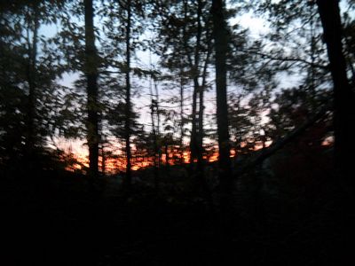 We
now had a couple of decisions to make. Since we were over ten miles into
this venture and knew that we had to be close to Cane Creek we walked back and
forth across the boundary trail looking for any sign of a trail split.
There was none. We knew we were in the Park because there were boundary
signs along the way.
We
now had a couple of decisions to make. Since we were over ten miles into
this venture and knew that we had to be close to Cane Creek we walked back and
forth across the boundary trail looking for any sign of a trail split.
There was none. We knew we were in the Park because there were boundary
signs along the way.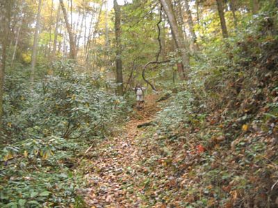 (martin drops down the steep Very Strenuous trail on Blackberry farms, we got to
reclimb this again)
(martin drops down the steep Very Strenuous trail on Blackberry farms, we got to
reclimb this again)
By now it was 7 pm and fully dark. Our options were grim. Neither Martin nor I was in a hurry to retrace this route for a twenty mile day. I got him into this so I figured it was my responsibility to find an escape route. I picked what looked like the most likely drainage and dropped off the side of the mountain. Martin had but a little e light and his phone. My plan was to follow the drainage until it intersected with something. I immediately dropped straight down the mtn into a dry creek bed and followed it until it got wet. I was now walking in the creek bed hoping to bump into something trying to not forget where I dropped off the side of the mtn so I wouldn't leave Martin stranded. This folly proved fruitless and I eventually decided to turn around as I hit rhodo hell after rhodo hell. Apparently, this drainage ran parallel to Cane Creek so I was wasting my time. The ascent was ridiculous. It was like ice climbing without an ice tool. At times, I was digging my hands into the side of the mtn to gain purchase and grabbing trees when they were available. Martin would Yo Yo to me and I would yell back so as not to get too far away on my climb. By the time I reached him, I was spent. He was playing with his phone and got cell service when his phone rang. Martin says, "It's YOU calling me, John." Of course it was Kathryn who remembered that I had packed my phone and we let her know that yes, we were overdue and would be very late if we made it in at all. By now, it was 8.30 or so and our options were limited.
We had to turn around. Since Martin had but a small LED light, it was slow going along this boundary trail. By the time we reached Beard Cane, we were out of water completely. I was focused on hitting that creek for some H20 and ran down that 6/10ths of a mile where we drank like camels from my filter bottle. Martin had been out of water for a while. I must have know that an epic was in the making that morning as I had a good breakfast/lunch in camp but I had eaten all the trail snacks save for a package of tuna. At the creek we were within sight of Campsite #3. They probably thought we were ghosts but we did not tarry. We had miles to go before we slept. Already pretty exhausted, we stumbled through the camp and lost the trail because someone had picketed a horse and it threw us off. Eventually we found it and began our walk back up Beard Cane with the dozens of stream crossings. What we did was cross one at a time, I would turn around and shine my light for Martin to cross. This made for slow going. A couple of miles into this death march we scared a bear or something in the brush and were too tired to even be bothered with it. The air was chilly whenever we stopped and we pressed on to campsite #11. It's funny how you can smell a campfire for miles away. After what seemed like an eternity, we saw the embers and decided to crash that party regardless. There was a guy sitting on the log, one of the guys from earlier in the day. We must have scared him, by now it was 11 pm or so. I asked if we could sit for a while and sat before he granted permission. Don't think this sat well with him. Martin and I later decided that he must have been stoned because he was acting strange and not very friendly. We were there about ten minutes before he excused himself and went to bed. Very odd, Scooter must have really given him the willies.
I ate the rest of the tuna, Martin downed some crackers and we drank water from the creek as this would be the last fluid for about four or five miles. The climb up Beard Cane was absolutely beautiful in the dark.
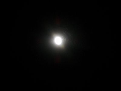
The moon illuminated the trail to the point we didn't really need headlamps.
I enjoyed this as much as possible despite some callousing blisters. I was
wearing tennis shoes due to the boot issue. When we hit the junction it
looked different from earlier in the day.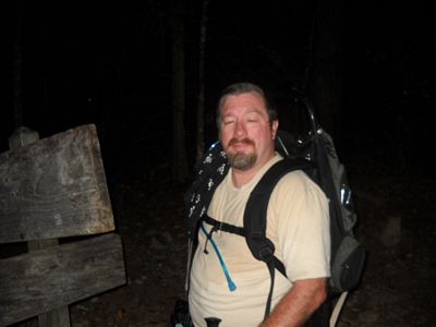
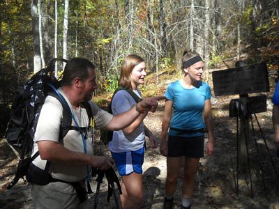 (Martin is showing the girls where to find the bathroom)
Now it is nearing midnight when we reach this junction
shown above. We are moving like the Bataan Death March. Rolling
rocks with our blistered feet and stumbling we are now a full twelve hours into
this epic but the camp is getting closer. When we finally reached the
junction, that last 6/10ths was like a marathon. At almost 1 pm we rolled
into camp. Jerky Mike and Jack had arrived. Bill was awake with
them, tending the home fires for us. We were never so happy to see their
ugly mugs. (shown departing next am, I was too knackered to take pictures)

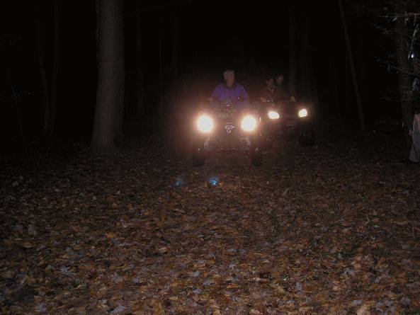
Comparing these two maps you can see how we were lured into thinking we had found the perfect secret loop. Examination at home showed that I was playing around on John's Ridge. That's for certain. I did about 22 miles that day but intend to find the linkage by going up Cane Creek and taking a better map. Martin was a real trooper. If you are ever in an epic, he's a good partner for sure. His optimism is contagious. Several thoughts come to mind about this experience, though. How is Blackberry Farms able to "own" a section of trail inside the park? Well, might be because they have a powerful benefactor and part owner, a man by the name of Lamar Alexander. (click name for a link on some info about his holdings there) Some of you may remember the last time we had a run in with them on ATVs last year at campsite #2. They came screaming into campsite #2 in the middle of the night with chain saws running.
,
Also, if you post a map, shouldnt it be somewhat accurate? Oh well, that's what we get, an epic story and plenty of hiking.
 Another interesting
story along the way involves this guy, Mark Hall. As I passed him
along the way up towards Ace Gap, I stopped him to inquire about the manway.
He knew nothing of it but was very nice. Martin strolled up and began
conversing asking if they hadn't perhaps met along the trail before.
Martin related that he had hiked some of the AT in 2007. Mark did not but
his daughter had done so. As we departed, Martin stopped, spun around and
said, "Splendora?". At which point, Mark stopped and walked back
towards Martin. "That is my daughter, he proclaimed" What a
coincidence. Martin had recognized this guy because he looked like his
daughter(trail name Splendora) with whom Martin had hiked along the AT in 2007.
Can you believe that? Only Martin could pull this off. Amazing.
Another interesting
story along the way involves this guy, Mark Hall. As I passed him
along the way up towards Ace Gap, I stopped him to inquire about the manway.
He knew nothing of it but was very nice. Martin strolled up and began
conversing asking if they hadn't perhaps met along the trail before.
Martin related that he had hiked some of the AT in 2007. Mark did not but
his daughter had done so. As we departed, Martin stopped, spun around and
said, "Splendora?". At which point, Mark stopped and walked back
towards Martin. "That is my daughter, he proclaimed" What a
coincidence. Martin had recognized this guy because he looked like his
daughter(trail name Splendora) with whom Martin had hiked along the AT in 2007.
Can you believe that? Only Martin could pull this off. Amazing.
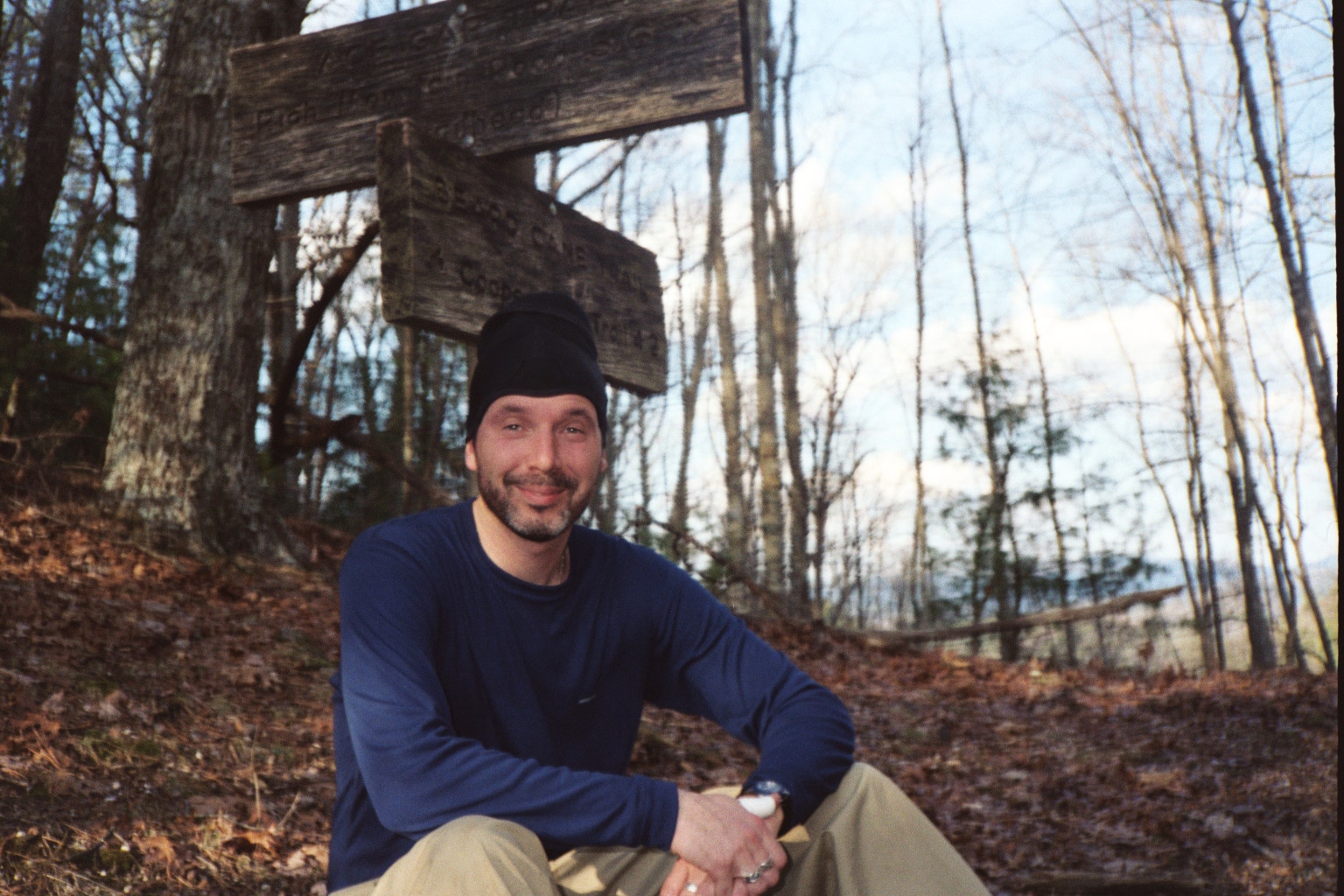 This is a picture of Grady
on the Beard Cane trail several years ago. He wasn't able to join us these
past few trips so I found a time when he was able to hike more often, before we
knew him. Doesn't he look like a young un?
This is a picture of Grady
on the Beard Cane trail several years ago. He wasn't able to join us these
past few trips so I found a time when he was able to hike more often, before we
knew him. Doesn't he look like a young un?
Also, we came up with a new Highlander term since Larry bailed on yet another backpacking trip that he said he would attend. It is not lying, it is Larrying. I am sure the traffic was heavy at the trailhead.
GSMNP-Campsite#2 Dayhike Adventure - Hiking - Spot This is a GPS view of what we did courtesy of Scooter's Spot. Don't know that I agree with it because it has a different loop out than what we came in and since we did the same trail I don't know how that could be. Anyway, check it out.